Deep Sea Fish and Sediment Surveys in the Gulf
greely
My job as a scientist and educator has been very rewarding. I love to share my enthusiasm, experiences, and joys of a career in science and teachign. For fun I listen to music, dance, hike, canoe, water ski, cycle, and enjoy being around people, especially family and friends. My day job is in the USF College of Marine Science as an Instructor and Coordinator of Education & Outreach programs.
Homepage: http://www.marine.usf.edu/education-and-outreach/index.shtml
Posts by greely

Day 2: Muddy Water
Aug 15th
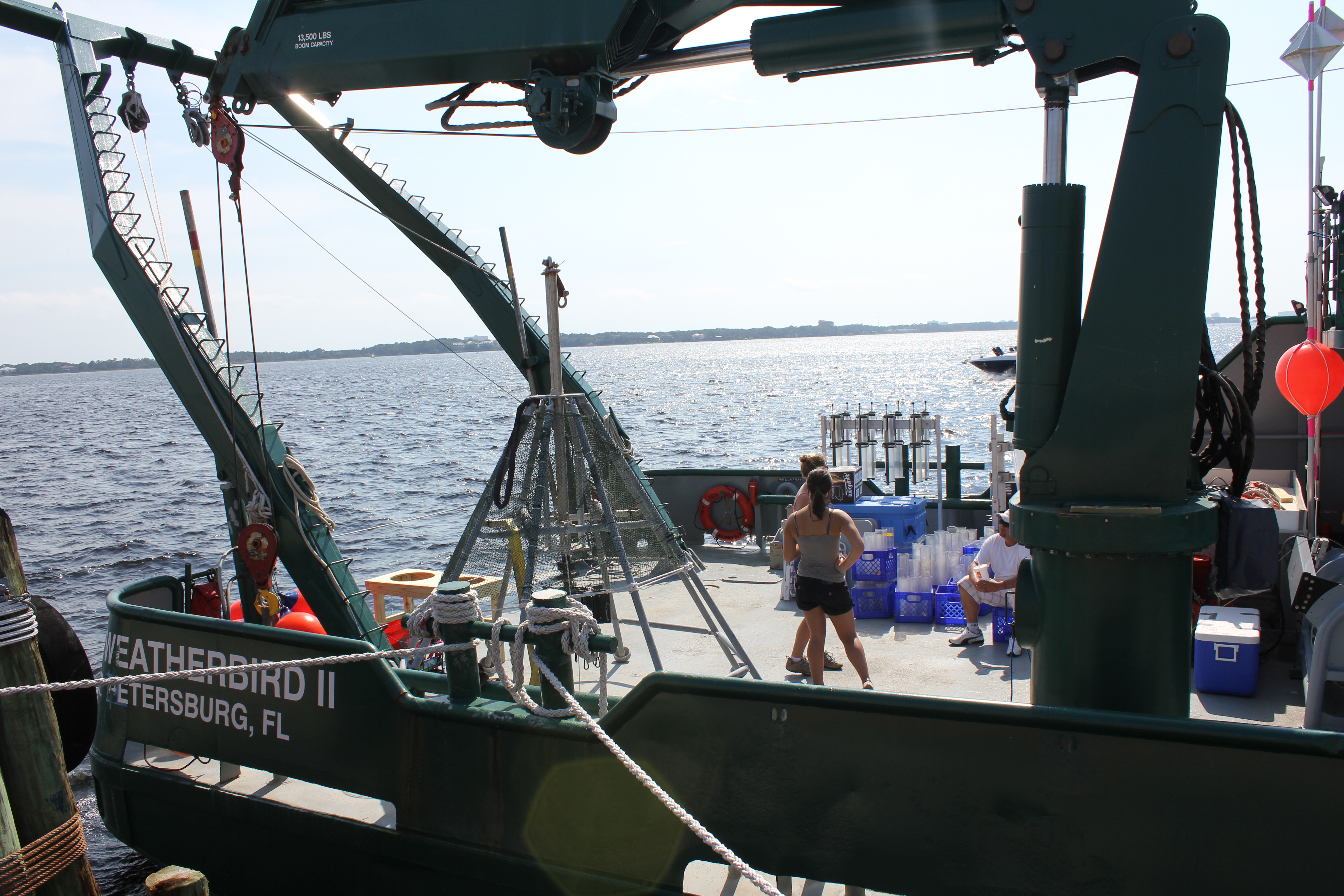
Day 2 Many sediment cores and fish are on the way
Ahoy, salty explorers! Teacher Patty and I are reporting from the night shift. We worked with the geochemist (Dave Hollander, Patrick Schwing and David Hastings) to collect ~16 sediment cores. It did not take long before we were snapping coring bottles in place on the Lunar Lander (Multi-core sampler).
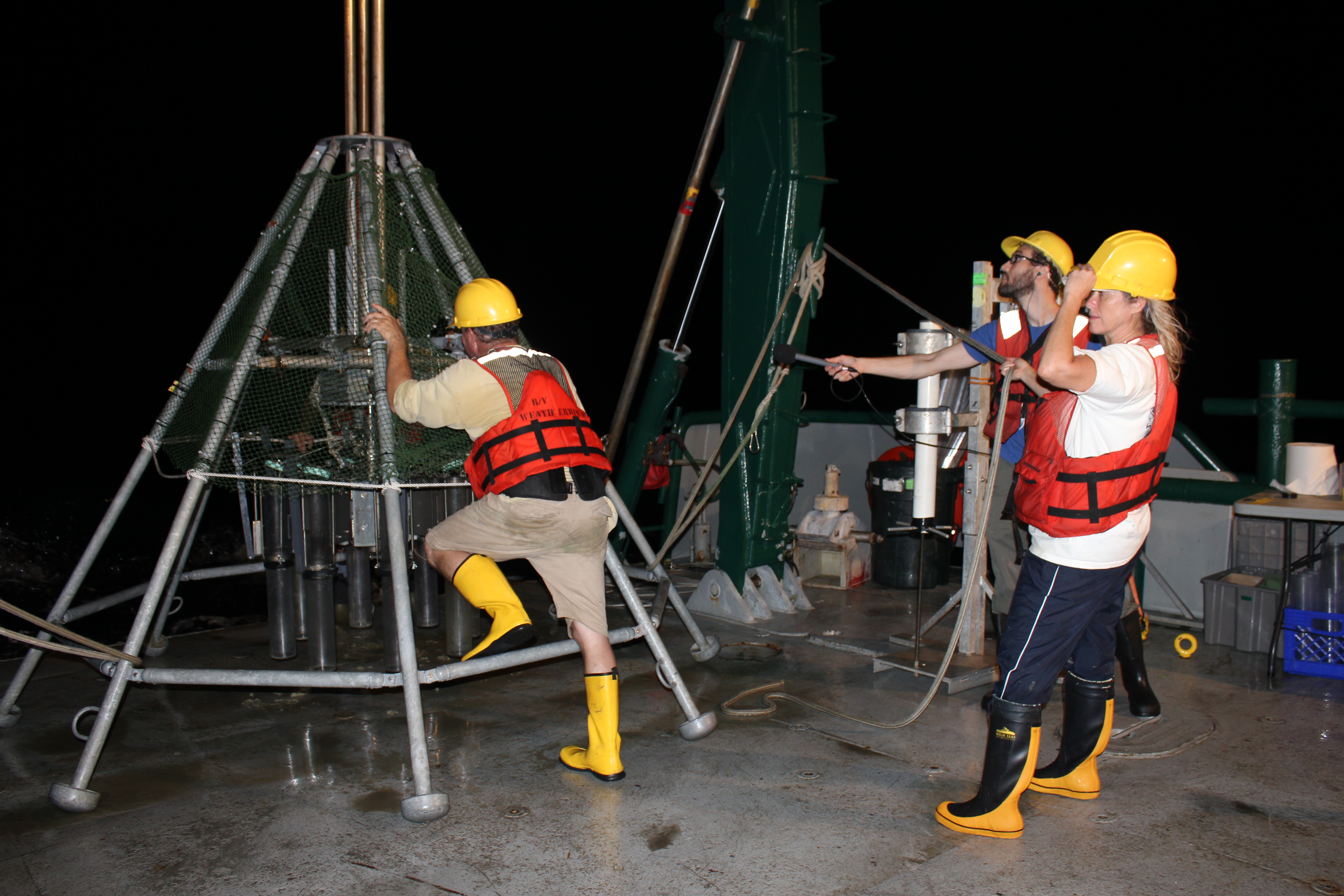
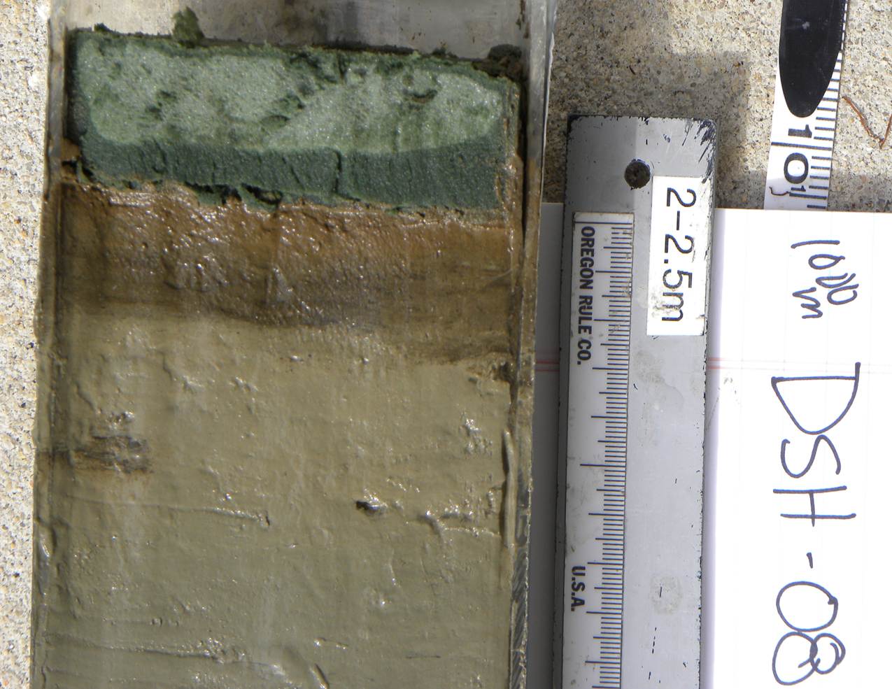
After sediment samples were retrieved from the ocean floor the cores were transferred from the Lander to new core liners for future processing. This was definitely a wet and muddy job! The sediment at 100 and 200 meters was well mixed and silty with a light brown color. One core from each location is split in two sections, photographed and visually described in more detail.
![]()
![]()
Here in the field we are collecting samples 24/7 and once we return to shore the lab work will begin to describe the sediment samples. The scientific information that will be collected from shore includes age dating (short-lived isotopes, like Lead 210, Radium 234), benthic ecology (microfossils- forams), microbial ecology of bacteria/viruses, hydrocarbon chemistry and basic sedimentology and redox biochemistry .
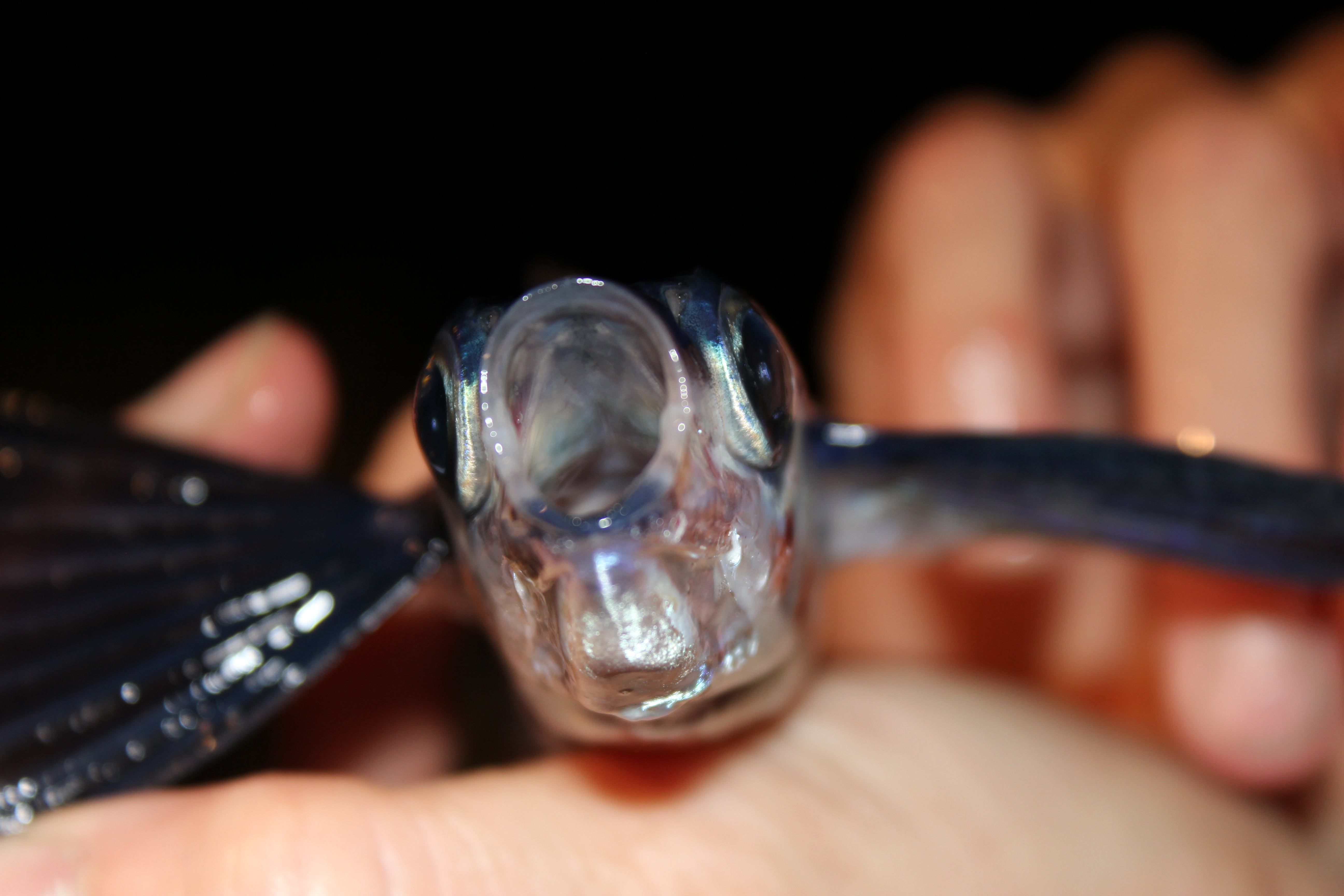
Some of the nighttime sightings included several dolphin chasing flying fish. Sometimes the flying fish would land on the deck of the vessel and we would help return them to the water.
All in all an excellent first day at sea with the C-IMAGE scientist, students and Weatherbird II crew.

Bon Voyage! The adventure begins…Day 1
Aug 14th
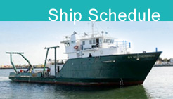
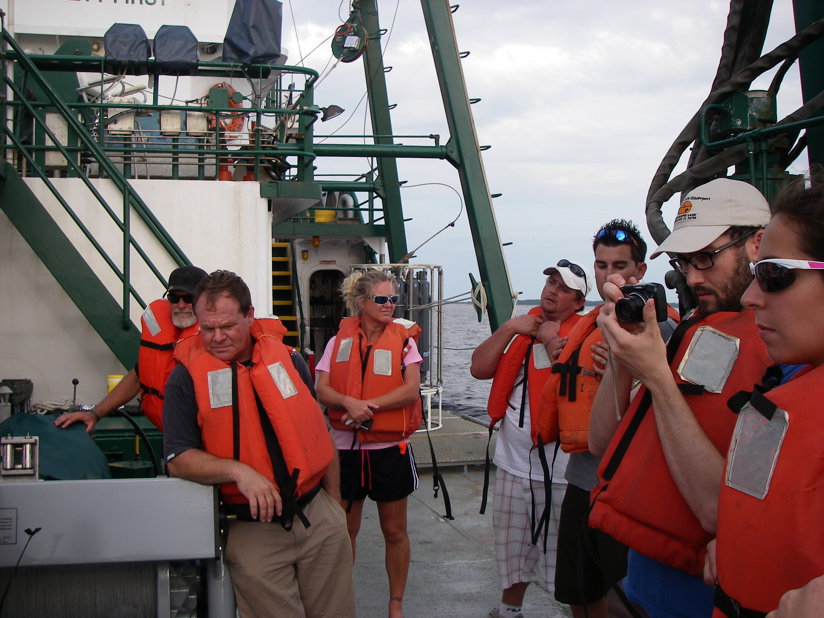
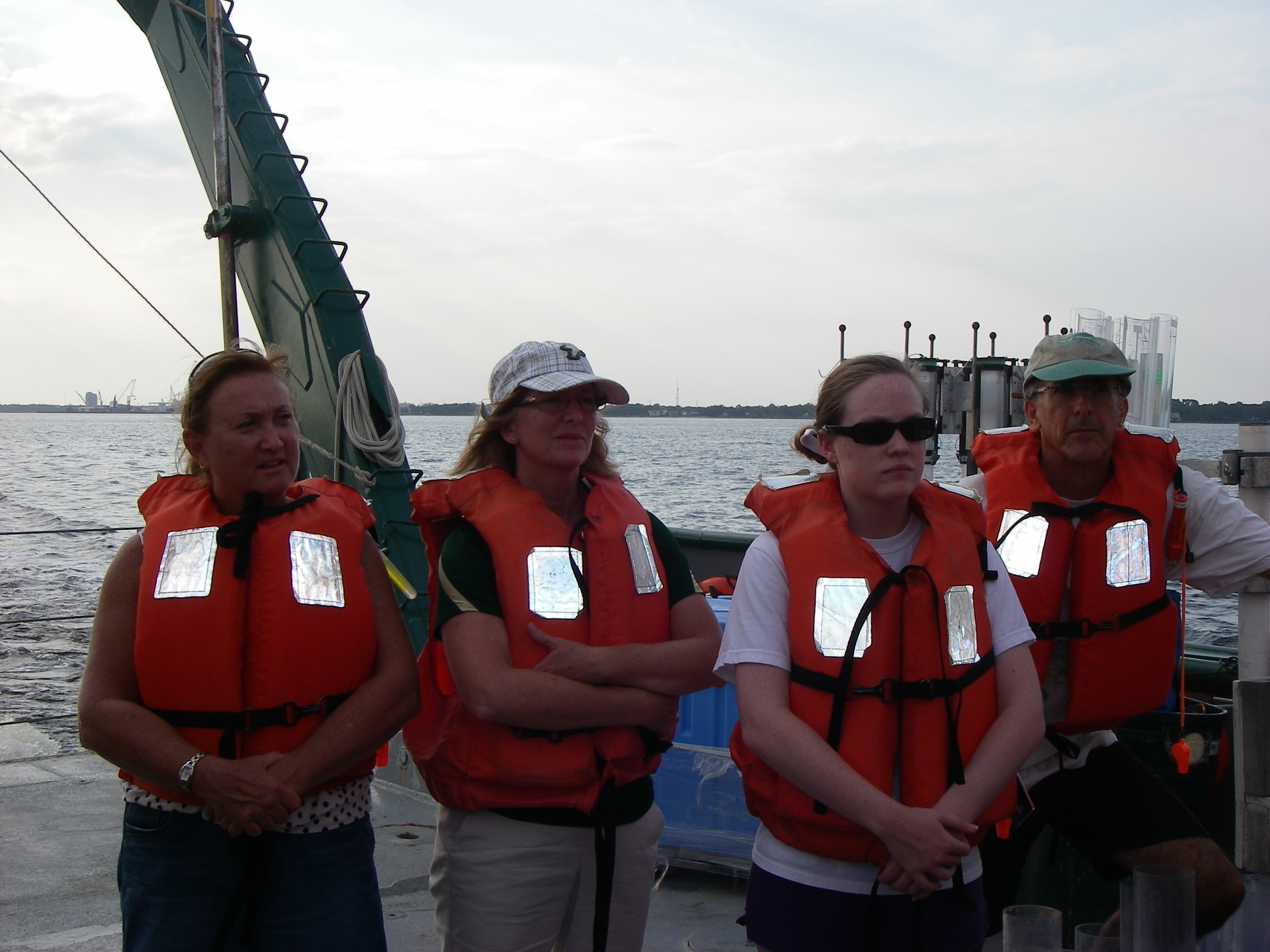
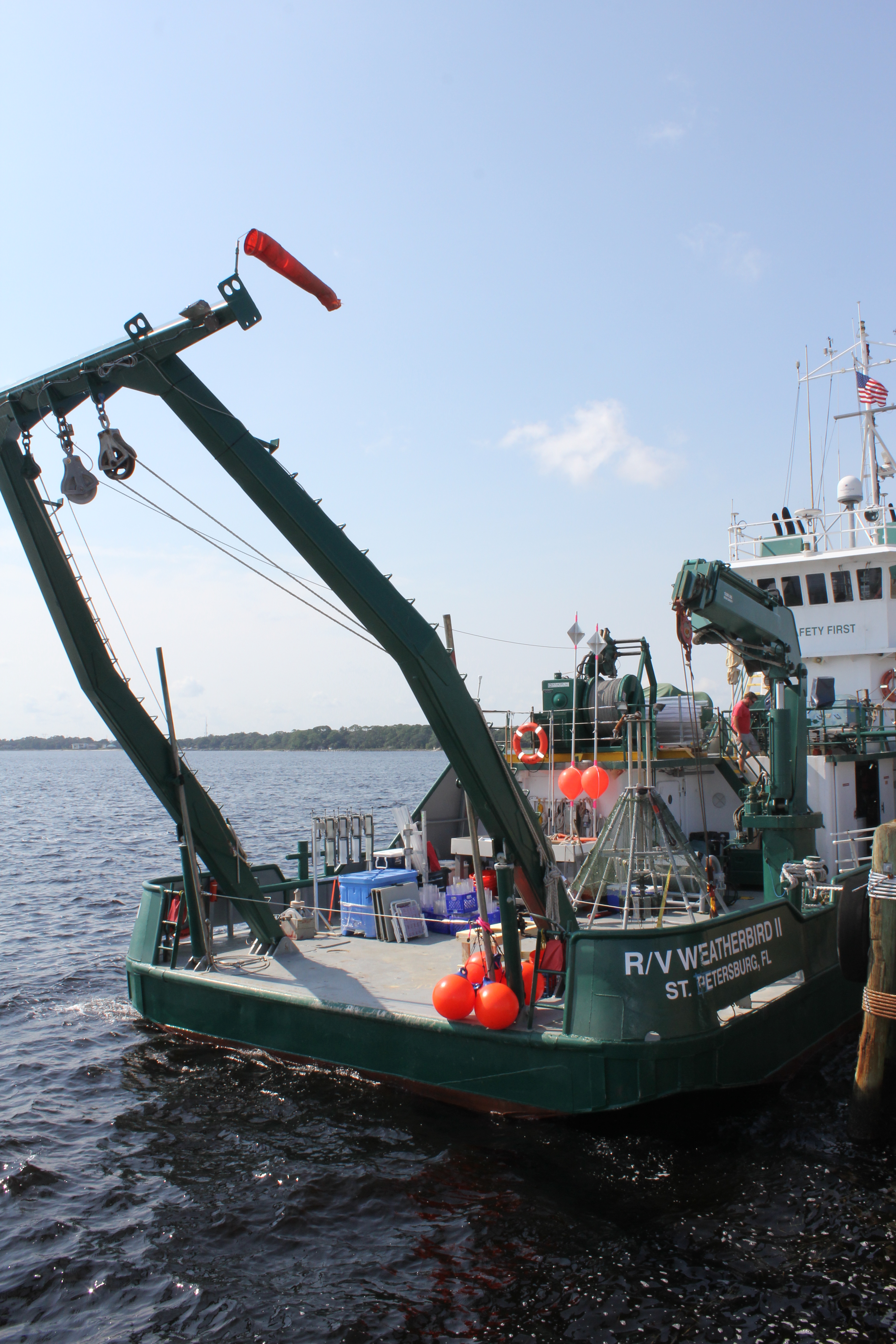 Ahoy, fellow explorers. After a ~500 mile drive to Panama City, loading the vessel and setting sail just before we are now sailing 50 miles from shore to first sampling station. Whew, a full day of anticipation as Patty saw the Weatherbird II for the first time, met the 6 member WB II crew, and 13 members of the science party. First things first… SAFETY DRILL.
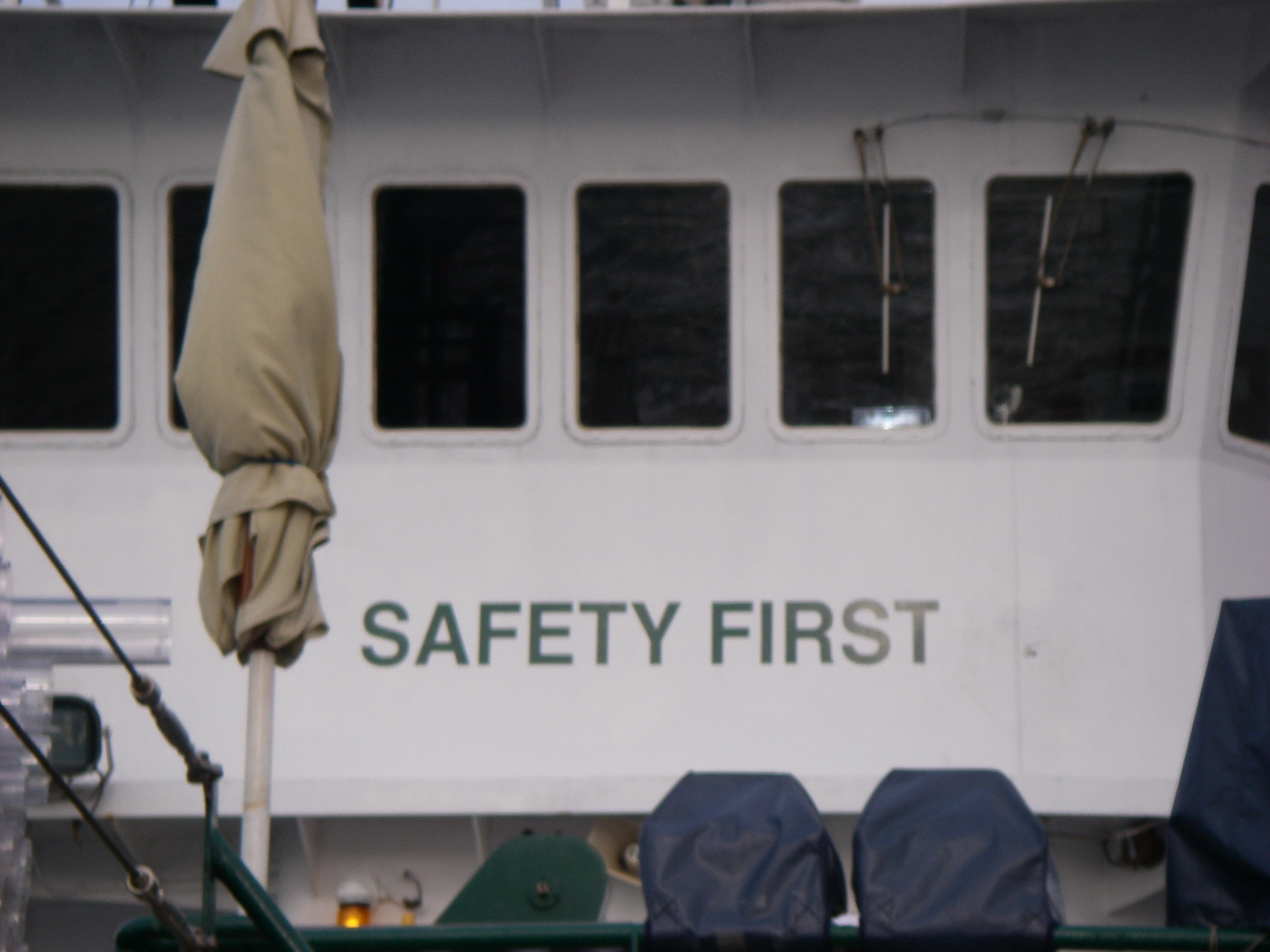
Before sailing safety is first concern aboard the Weatherbird II
Patty’s first impressions… “this is not the Royal Caribbean!” and, “where is the chocolate fountain?” Seriously, it was really cool to see up close and personal the oceanic equipment that I teach my students about and soon I will see how it all works as we begin our first sampling at 11:30PM.

Now that everything is loaded we have set sail. Meet some of the VIP’s aboard the expedition.
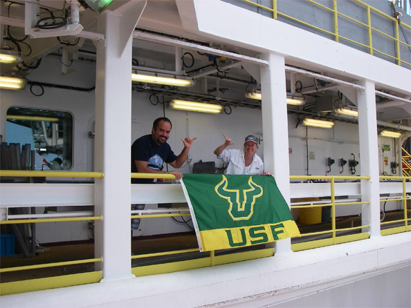
During this Adventure at Sea, your ‘cruise director’, Teresa Greely did not bring Rocky the USF Bull aboard but has the honor of sailing with the USF College of Marine Science’s Dean, Jacqueline Dixon and our C-IMAGE Teacher at Sea, Patty Smukall.

Jacqueline Dixon, Dean USF College of Marine Science
(Marine Geologist- Volcanologist)
C-IMAGE Teacher at Sea, Patty Smukall from Wekiva High School
Keep sailing with us as we all prepare to work around the clock, 24/7 to gather as much scientific information as possible during our seven day Expedition in the Northern Gulf of Mexico.

Coming soon, meet the scientist, students and crew aboard the WBII and discover how the samples of sediment and fishes are collected.
A New Adventure: USF C-IMAGE Scientists Host Teacher at Sea Program
Aug 13th
Ahoy, ocean adventurers! Join us as we set sail on a new Adventure at Sea to the northern Gulf of Mexico with Patty Murphy Smukall, our first Teacher @ Sea. The expedition will be from August 14-21. We will board the research vessel Weatherbird II in Panama City then sail to Desoto Canyon to begin the research. Follow us as we join USF scientists to help answer questions about the current ecology of the Gulf.
The mission of the C-IMAGE cruises is to help to answer several fundamental questions about the Deep Water Horizon (DWH) event and subsequent impacts on the plankton population, reef and fish communities and the microbial communities. Deep sea sediment samples, plankton and fishes collected during these expeditions will be the data source. Teachers will be part of the scientific crew and participate in the at sea research. Sampling activities include the use of the Sipper plankton sampler, multi-core sediment system and long line surveys to assess fish health.

While at sea teachers will be the ship to shore communicators via social media (Twitter and daily blogs) and LIVE video conferencing with formal and informal classrooms. Marine scientists, post-docs and graduate students participating in the C-IMAGE cruises will collaborate with the teacher on board to communicate the science, technology and life at sea experiences to educational and general audiences.
While on shore teachers will translate their At Sea learning experience to understandable inquiry-based lessons about the science and technology encompassing the northern Gulf of Mexico ecology, the DWH event and subsequent impacts. Lessons developed from the cruises will inform a future series of C-IMAGE Teacher Professional Developments during Phase 2 of Outreach & Communication. Once developed lessons will be available to science educators electronically via the College of Marine Science Education & Outreach . The overarching goal of our outreach activities is to advance ocean sciences literacy and education by understanding and applying the science we learn along the way.
If your classroom, school or other educational facility would like to participate in a LIVE video conference during our expedition, please contact Teresa Greely, greely@usf.edu for details.
- Teresa on deck of JOIDES Resolution during LIVE! Aboard the JR video-conference to USF Honors students. Photo credit Etienne Claasse
Follow USF alumni, PATTY MURPHY SMUKALL, as our first Teacher at Sea!
Patty’s science footsteps. Patty is a science teacher who has taught Marine Biology, Biology, Earth Science and Physical Science. This school year she will be teaching 11-12 grade Marine Science classes. She has been teaching in the classroom for 22 years and 5 years at zoos/aquariums, including Sea World and Mill Mt. Zoo. Patty has always been interested in the ocean and its inhabitants, ever since she watched “Flipper” as a little girl. She followed the dream of working with dolphins by attending USF and majoring in Zoology. The dream became reality when she began her science career working at Sea World with dolphins, manatees, sea lions and other marine mammals. Later, she realized that the best way to have an impact on conservation is to teach the next generation to care. She has spent the last several years teaching Marine Science, currently at Wekiva High School in Apopka, Florida.
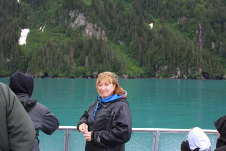
Patty’s recent visit to Alaska.
Cruise Plan
The goal of this cruise is to evaluate the extent of fish disease and to characterize the distribution and fate of oiled sediment at sites on the continental shelf and slope of the northern Gulf of Mexico Gulf of Mexico. Sampling activity will include long-line fishing, sediment coring and water column hydrography.
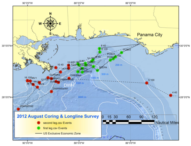
Map view of proposed sampling sites and ship routes for Leg 1 (green) and Leg 2 (red).
Gulf of Mexico Teacher @ Sea Program
The C-IMAGE Gulf of Mexico Teacher at Sea Program is offering three expeditions for In-service Science Teachers in Florida. Current dates of the expeditions are:
- August 12-21 Fish Health Surveys………. Application Deadline 7/25/2012
- October 19-31Deep Ocean Sediments……..Application Deadline 9/19/2012
- November 2-8 Zooplankton Survey…………Application Deadline 10/02/2012
The C-IMAGE program strives to integrate facts with other research, integrate facts into knowledge, and disseminate information to the public and decision makers

This research is made possible by a grant from BP/The Gulf of Mexico Research Initiative.
Contract #SA 12-10/GoMRI-007

Visit JR Expedition 340 Blog
Apr 1st
Readers please visit the expedition blog at http://joidesresolution.org/blog/281 for details about weekly science findings, people aboard, and other curiosities during Expedition 340.

Teresa on deck of JR during LIVE! Aboard the JR videoconference to USF Honors students. Photo credit Etienne Claassen
A few days ago I was able to give a lesson to my students, but this time the JR was the classroom. This was made possible thanks to the JOIDES Resolution Live! program that is sponsored by the Deep Earth Academy providing live video broadcasts with the educators and scientists on board the ship during every expedition. This is the first time a USF class has been taught while a professor was at sea. This provides a unique opportunity for students in my natural sciences classes to experience more directly the field based aspects of scientific research as well as ask questions about the science
as it is unfolding during our expedition in the Lesser Antilles. We are broadcasting to two locations in the USF family—campuses in Tampa and St. Petersburg Florida. A special thanks again to Deep Earth Academy for this
nything but typical ‘science’ class.

Why Submarine Sediments near Volcanic Islands?
Mar 31st
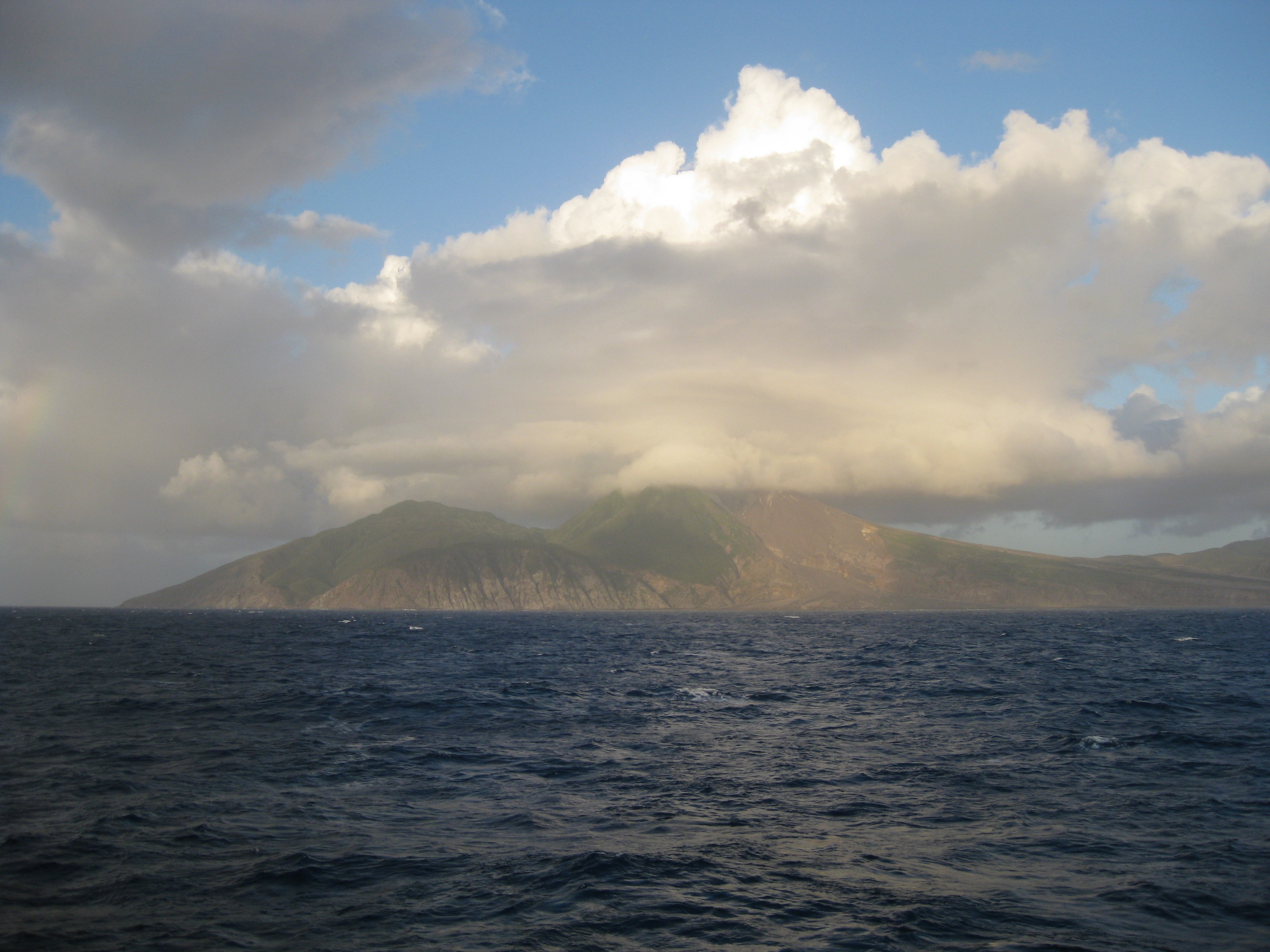
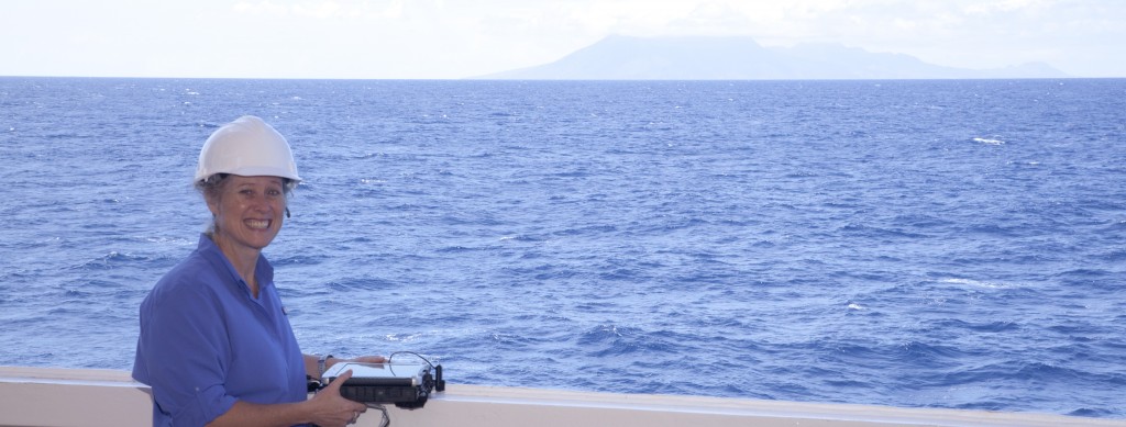
Island of Montserrat with active volcano Soufriere Hills in view. Photo credit Takeshi Saito.
We are sailing in the Lesser Antilles or West Indies of the Caribbean Sea. Scientists aboard the JR such as volcanologist, sedimentologist, inorganic geochemist, and micropaleontologist are at this location in the ocean because of the volcano on Montserrat, called the Soufriere Hills volcano. This is one of the best studied volcanoes on the planet. The eruptions began in 1995 and continue today. In 2003 the dome (top) of the volcano collapsed. Scientists estimate that over 70% of the erupted material has washed into the adjacent ocean. The surrounding seafloor was quickly covered with volcanic deposits.
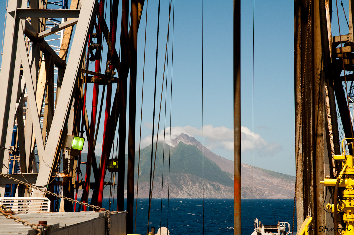
From stern of JR the island of Montserrat with the volcano Soufriere Hills in sight. Photo credit Etienne Claassen
Since the 1995 eruptions the volcano has been under continuous surveillance. Both England and France have observatories on the island to measure and document the behavior of the volcano. In particular a detailed series of data before and after eruptive events has been compiled. Scientists have generated lots of data from land-based measures and from submarine cores collected to depths of about 6 meters in the seafloor. This means that Montserrat is one of the best studied volcanoes on the planet!

Assembling drill pipe for drill string. Photo credit Adam Stinton
Now it is time to go deeper into the seafloor to discover the volcanic history of Montserrat over several million years
ago, maybe even longer. A major question for Expedition 340 is to explore what happens when the majority of volcanic material (pyroclastics) extruded from magma, flows into the ocean? Now for the first time with the technology and brawn of the JOIDES Resolution we can obtain cores from deeper in the seafloor, thus on longer time scales than previously known. The 340 expedition is going back in geologic time to gather data about the long-term history of the volcano over the past million years. This task can only be accomplished through scientific ocean drilling. The data from Expedition 340 will help scientists around the world better understand the modern day events occurring in the Lesser Antilles island arc, in particular the potential for future hazards such as eruptions and tsunamis.
- By retrieving ocean based cores we are sampling the geologic archive that lies beneath the seafloor.

Rocky and Teresa visit moon pool
Mar 31st
Our favorite memory for today
Today, lil’ Rocky the Bull (VIP Aboard the JR) and I visited the moon pool. This is one of the coolest places on the Jr. It is located below the drill floor a deck below where my office is located on the Foc’sle Deck (Forecastle or F Deck). A hard hat and safety glasses are required, ear plugs are suggested too. What is the moon pool? The moon pool is a 7 meter opening in the main deck of the ship, giving access to the water below, allowing technicians or researchers to lower tools and instruments into the sea. The drill string is lowered from an opening in the drill floor through the moon pool to the seafloor. Hope you enjoy these photos as much as I enjoyed my visit.
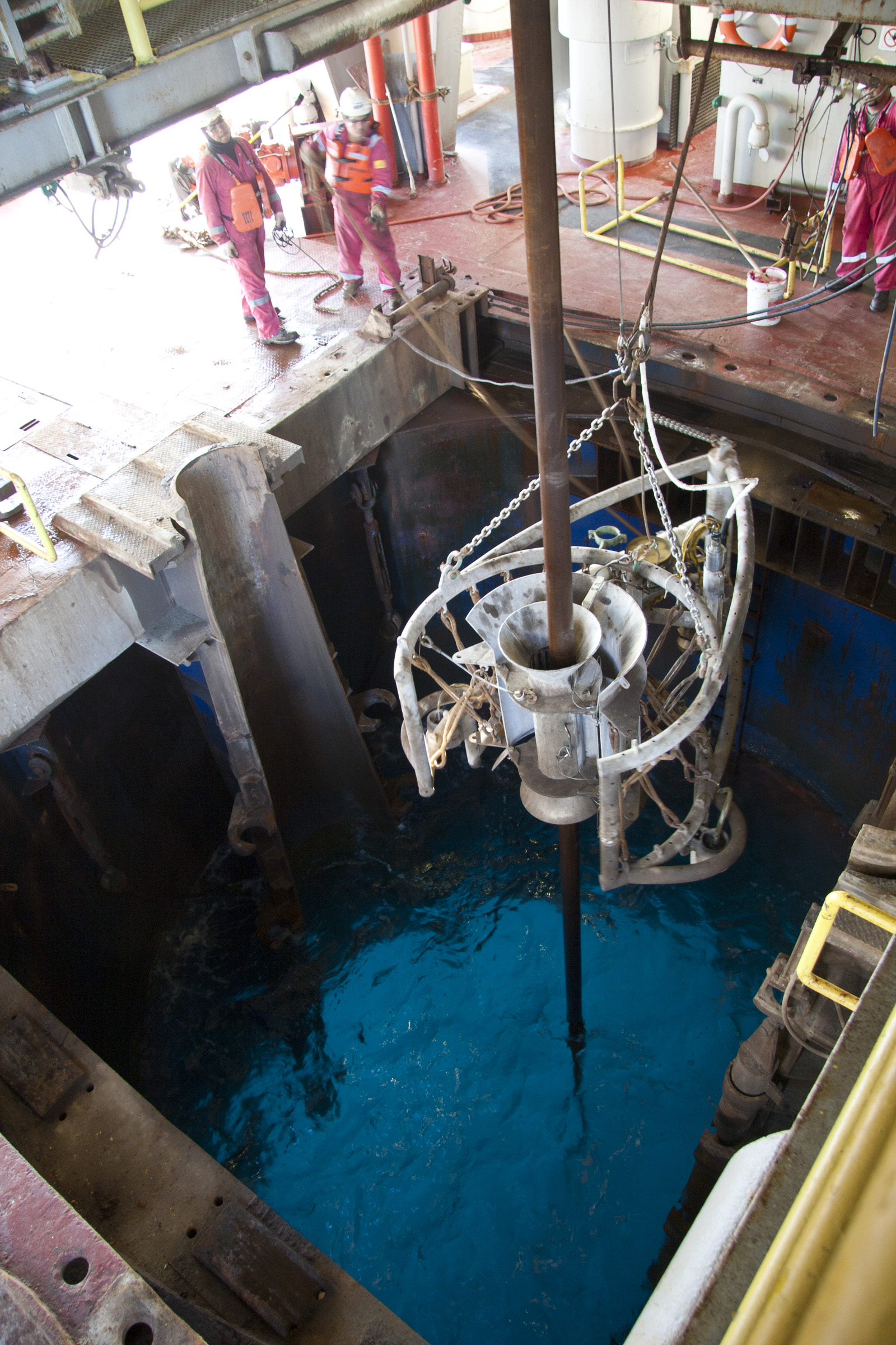
Moon pool is a 7 meter opening in the main deck of the JR where the drill string, bottom hole assembly and logging instruments are lowered to the seafloor. Photo credit, Bill Crawford, IODP photographer
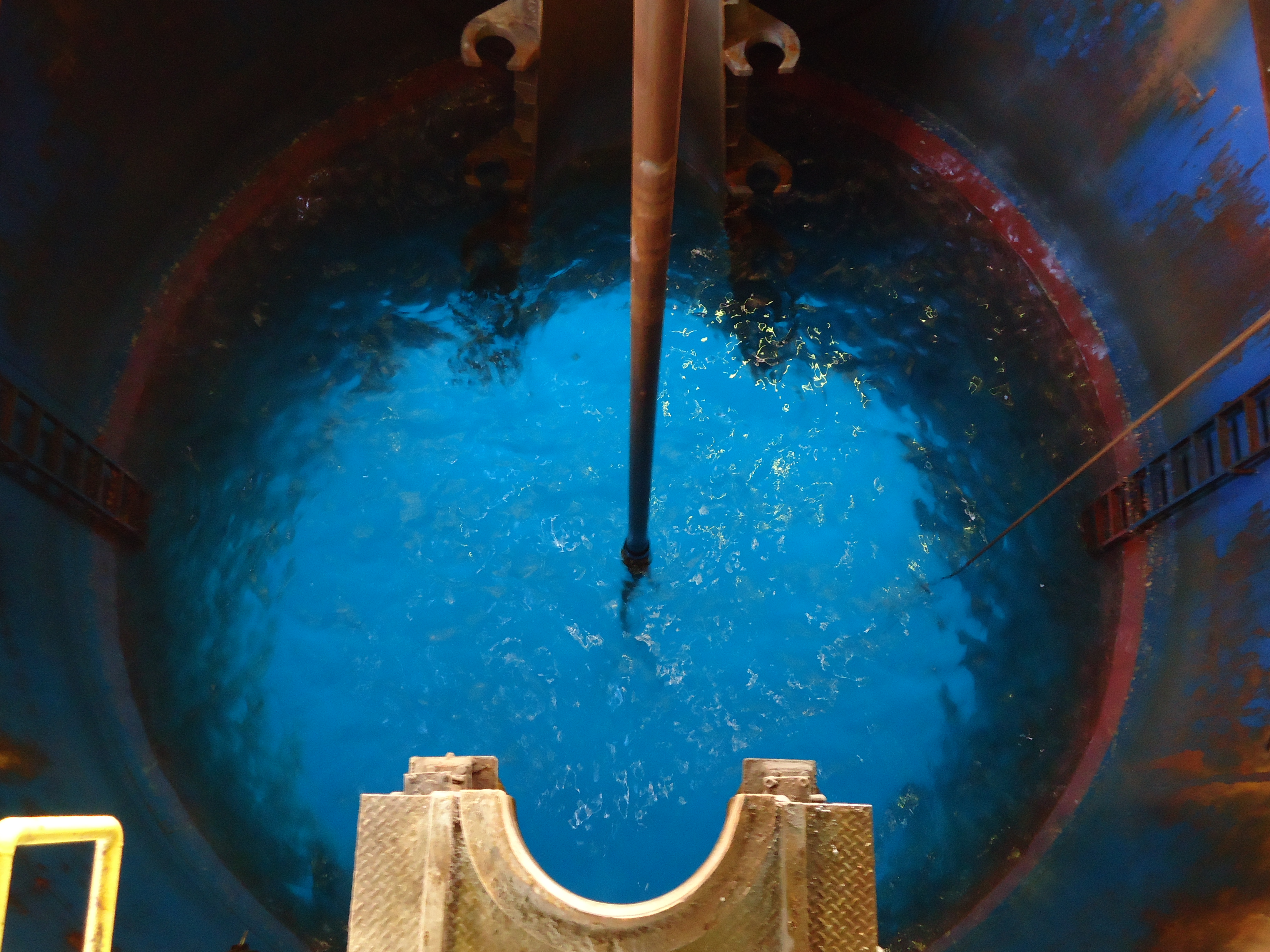
A close-up view of the moonpool. Photo credit, Bill Crawford, IODP photographer

JR Drill Floor: Where it all begins
Mar 31st
This is where all the action begins– the drill floor. Take some time to enjoy this YouTube video of the
JR Core Journey from Rig Floor to Core Receiving Deck to Core Lab (really nice narrated video)
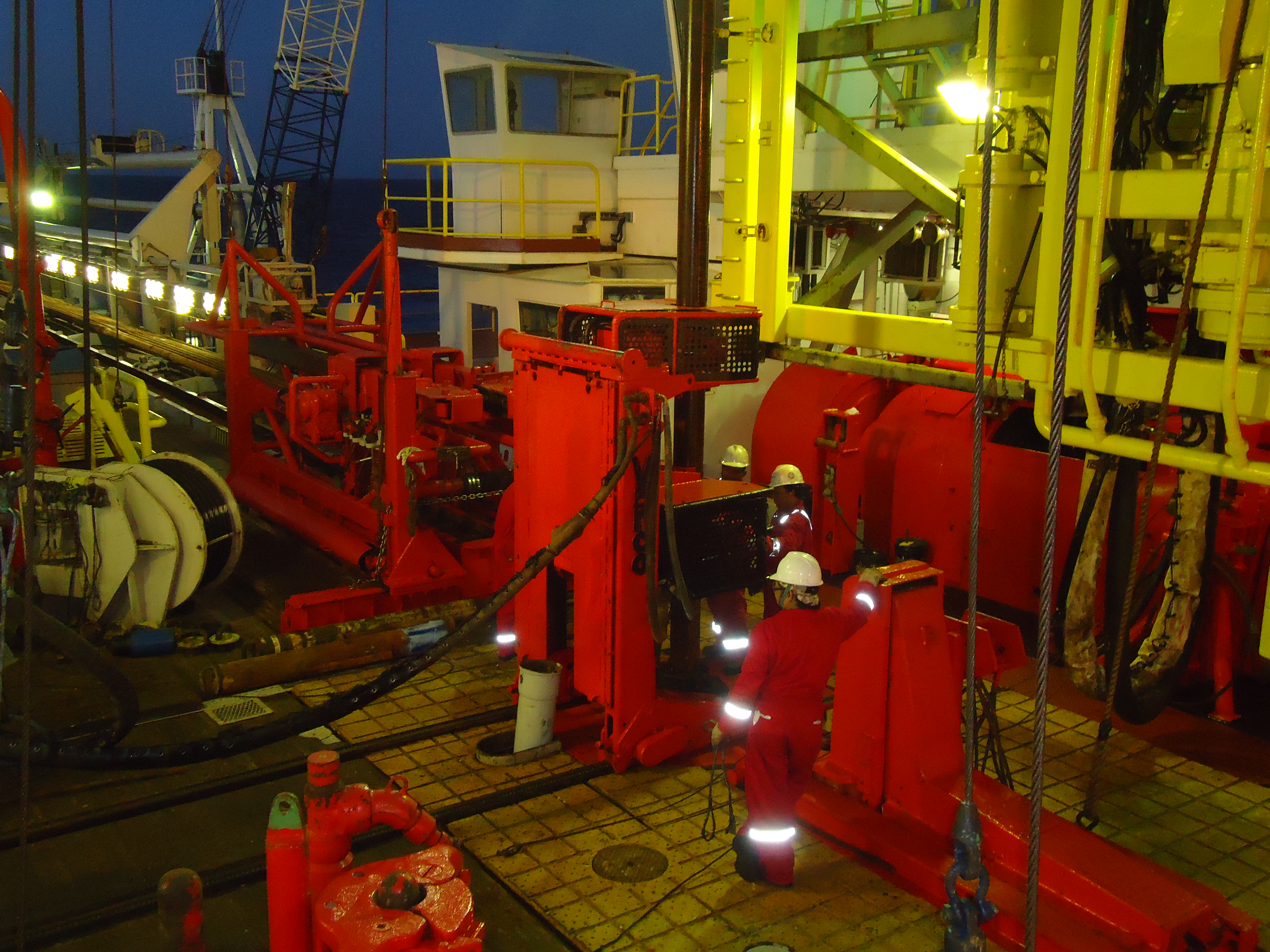
JR Drill Floor, the drill string is the brown structure in center of photo, this is a series of pipes joined together to transcend the depths of seawater then penetrate the seafloor with a drill attached at the base. Photo credit, Adam Stinton, Expedition 340 Volcanologist

Go Bulls!
Mar 16th
Michael Martinez-Colon (CMS graduate student) and I showing our USF support for the Men's Basketball team's accomplishments!

Day 2 @ Sea, Educator’s Blog (March 6, traveled 190 nautical miles today)
Mar 13th
Meet the JOIDES Resolution
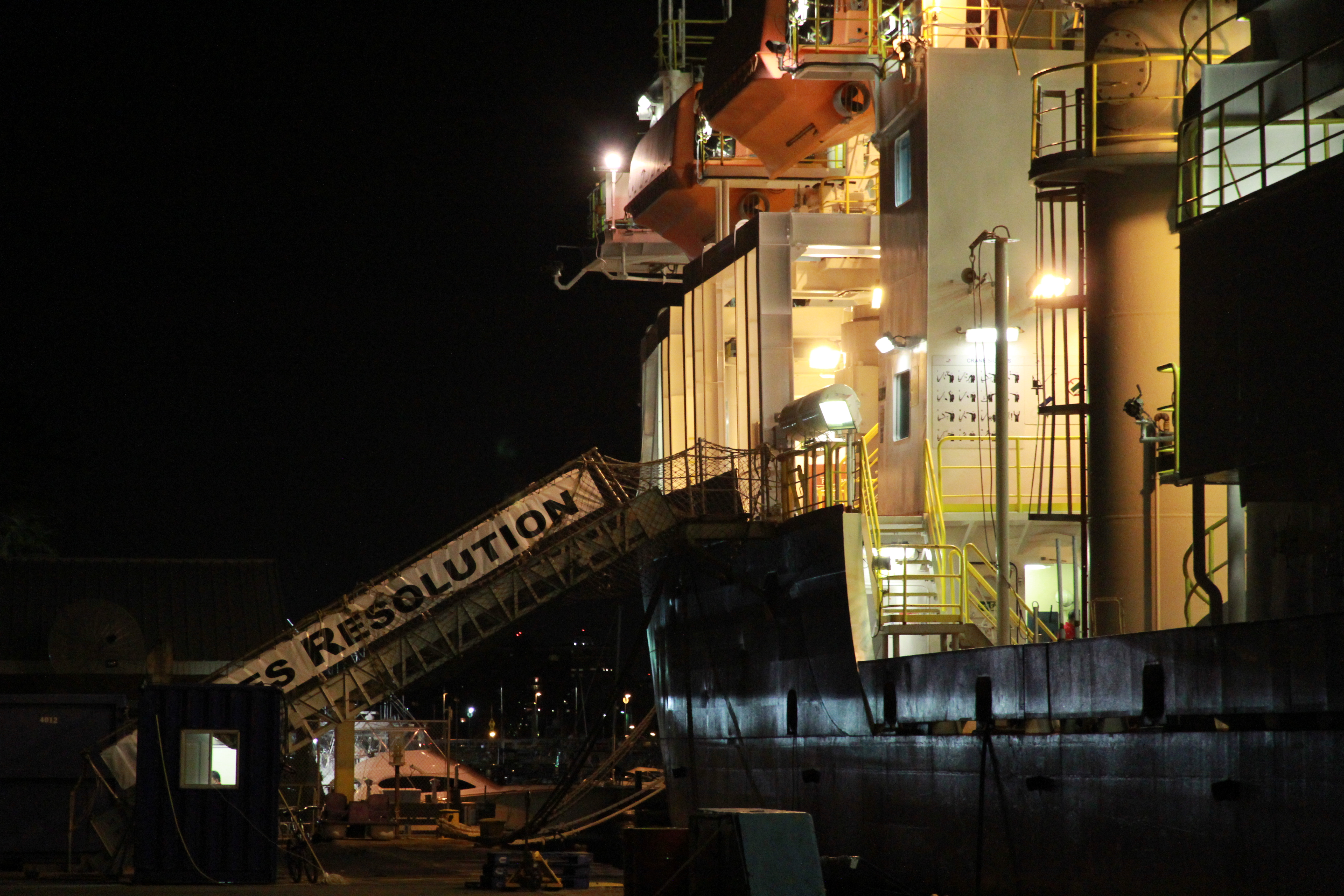
Enjoy this image of the JR at night. The JOIDES is a beautiful site day or night sunset or sunrise. The JR has traveled almost 500,000 miles, crossed the Equator; Arctic Circle, and Antarctic Circle several times, drilled in all the ocean basins and recovered over 155 miles of core. Only a vessel equipped like this one is capable of the research we soon begin our search for earth’s secrets in the Lesser Antilles.
Another point of interest about the JR is that it can drill down more than 2,000 meters into the seafloor and in waters as deep as 7,000 meters. Wow, 2000 meters into the earth’s crust.
A good night’s rest
We have been sailing through the night and awoke to beautiful deep blue water. There is nothing like sleeping aboard a vessel. Something about the humming engines and gentle rock to and fro that makes sleep deeper and more peaceful. Well, unless you do not yet have your sea legs!
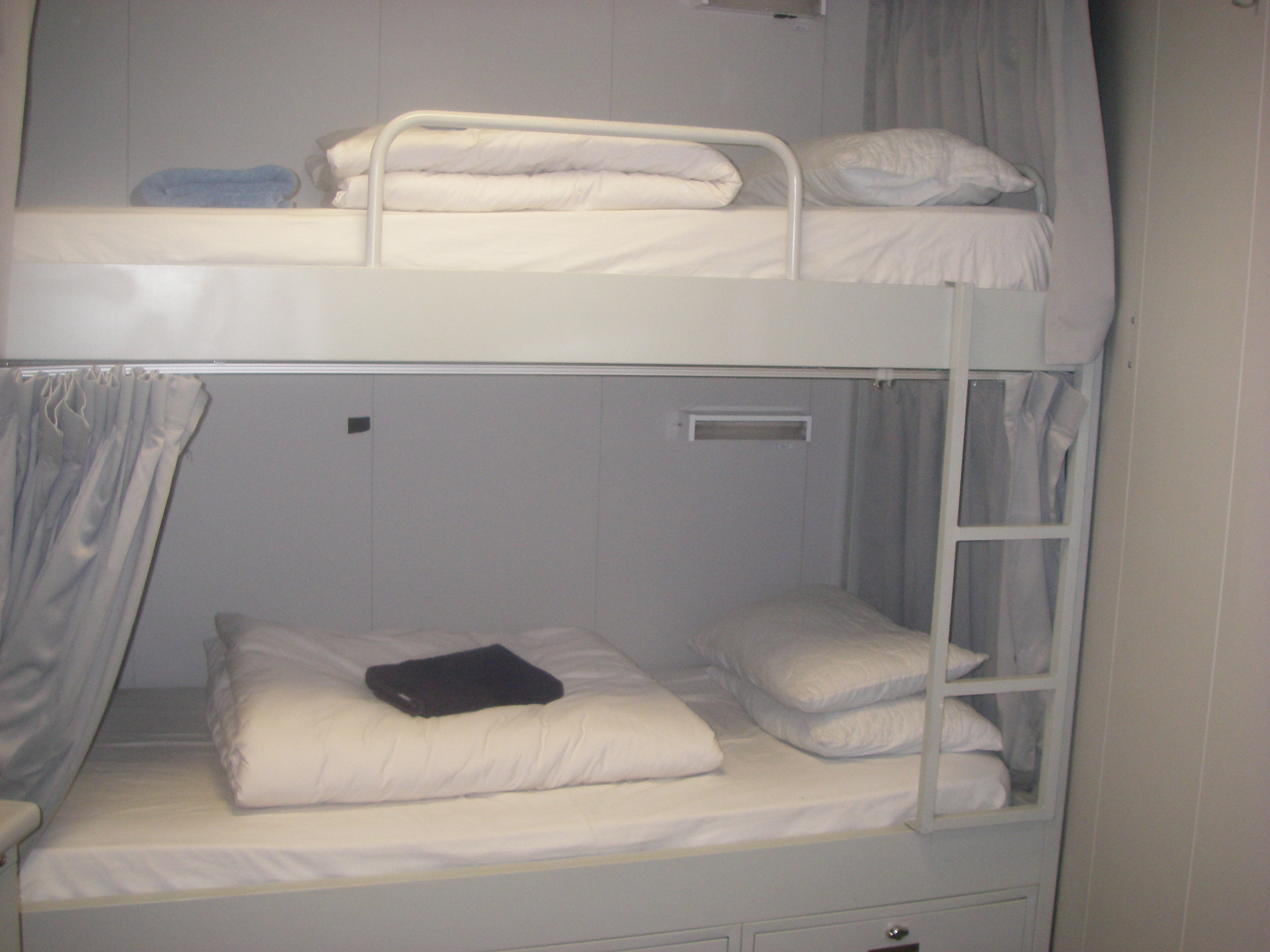
This is where we sleep aboard the JR. The living accommodations are called the Hotel. When below deck in our quarters we must keep the noise level to minimum because we work around the clock, so someone is always sleeping and someone is always working.
Sunset between Volcano Peaks
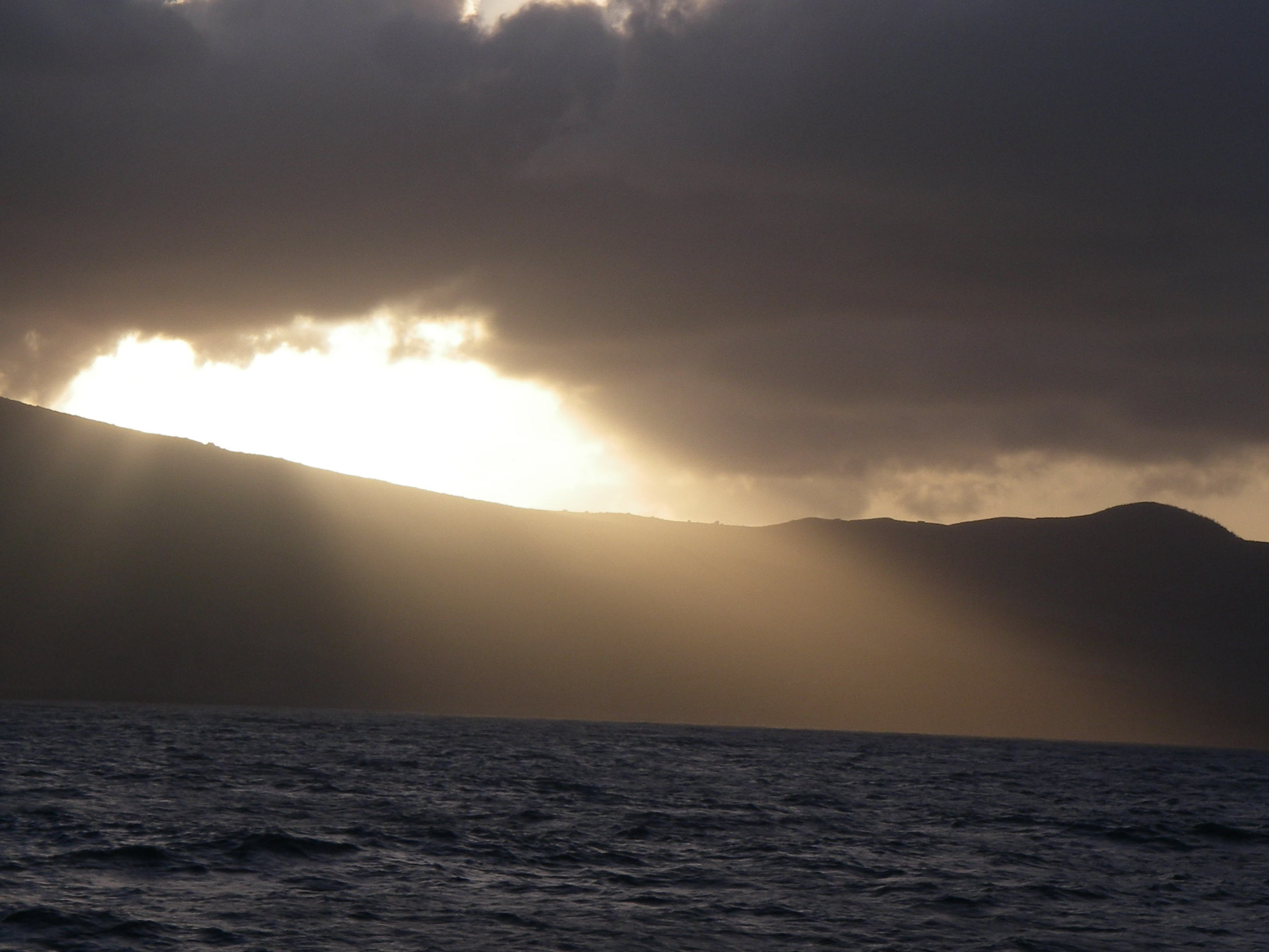
Day two of our travel in the late afternoon we had our first glimpse of the Lesser Antilles islands. We first passed Antigua and then continued south to Montserrat. What a spectacular volcano! We are at our first sampling location after traveling 347 nautical miles in about 33 hours. It is almost time for sunset so the entire volcano is not visible. The sun is setting on the west side of the island and the JOIDES Resolution is anchoring on the Eastern side. Here is a photo of the island as the JR stopped steaming in order to begin preparation of the sampling site for drilling.

Day 1 @ Sea, Educator’s Blog (March 5, traveled 157 nautical miles today)
Mar 13th
Bon Voyage! We have only just begun
Greeting ocean explorers! It is official: we are sailing. We left port from San Juan, Puerto Rico on March 5 and are en route to our first sampling location. It was a great feeling to hear the props turning, engines humming and tugboats assisting as we left the harbor. The entire science crew was on deck for the Bon Voyage, filled with excitement and anticipation of the earth’s mysteries that would be revealed during Expedition 340.
-

- This logo on the port and starboard side of the JOIDES Resolution says it all; we are beginning our journey as ocean detectives hoping to uncover the earth’s mysteries preserved in the ocean’s floor.
-

- Its official no going back, the gang plank has been hoisted we are now all aboard.
-

- This photo of the ship’s wake was taken from the stern of the JR as we set sail and had our last glance of land for 40 days.
-

- The Expedition 340 science party assembled on the main deck as we set sail for the Lesser Antilles.

Meet the chief scientists for our Expedition who have collectively written the script for this exploration through the proposal process. Because of their success we will soon attempt to retrieve our first glimpse of the seafloor around the islands of the Lesser Antilles at greater depths than before possible thanks to the technology and brawn of the JOIDES Resolution.
Safety First!
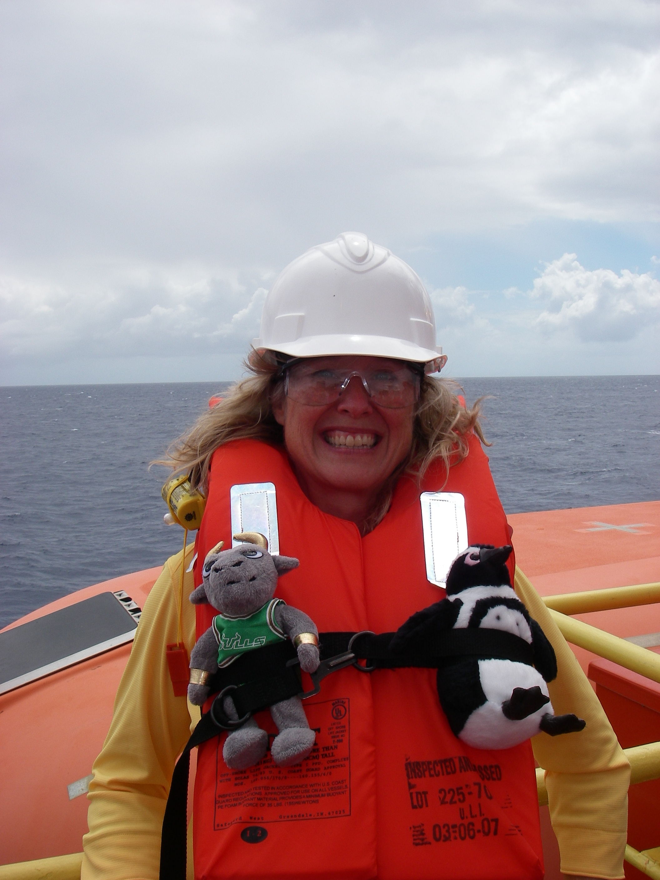
Photo of Teresa in safety gear with USF’s Rocky the Bull and Honors’ class mascot Mr. Flajelly the Penguin.
First task after we had sailed a few hours was to have our all hands Safety Drill. When the very loud bell rang, we all grabbed our life vests, eye goggles and hard hats. Sort of like ‘March of the Penguins’ we all climbed the stairs to the life boats to await our instructions. Joining me for the safety drill were two VIPs aboard the JR, USF’s very own mascot Rocky the Bull and another mascot Mr. Penguin from the USF Honors College students in my class this semester.